150x100cm non woven world physical map with national flags plate for office wall home decor school supplies

Non-woven Geographic Map of The World In Russian 150x100cm Large World Map Wall Sticker for Education School Office Supplies
1068.67 Руб.

150x225cm DIY World Map Made With Country Flags Pattern Non-woven Decor Map For Wall Decor
1214.19 Руб.
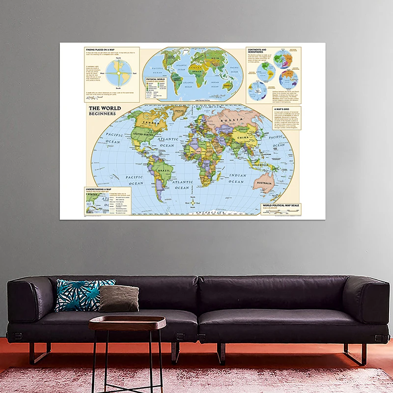
Physical World Map 150x100cm Non-woven Foldable Map With Detailed Label Without Country Flag For Beginner
926.86 Руб.

150x100cm The World Physical Map With World Land Cover And Landforms Non-woven Map With Country Flag For Education
1624.79 Руб.
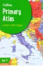
Collins Primary Atlas
The must-have atlas for children aged 7-11 Collins Primary Atlas is a great introduction to mapping of the UK, Europe and all major regions of the world. It supports the Key Stage 2 curriculum and is suitable for children aged 7-11 years. This new, fully up-to-date edition includes information on map reading skills, the meaning of scale and measuring distances, and is ideal for classroom use or home learning. Reference maps: - Informative, politically coloured and easy-to-read - National capitals and major cities are clearly labelled - Maps are supported with national flags and basic national statistics Continental maps: - Linked to regional mapping - Supported by a selection of aerial and terrestrial photographs - Relief maps show layer colouring and highlight major physical features This atlas is also available in a Kindle format. The next atlas in the series is the Collins School Atlas, suitable for ages 11+ and KS3.
2304 Руб.

90x60cm Non-woven World Map Posters with Country Flags Waterproof No-fading Physical Map of The World Vintage Wall Art Decor
1686.89 Руб.

150x225cm Non-woven DIY World Map Plate Pattern Made of Coffee Beans Home Wall Decorative Poster Map for Home Hotel Office Decor
1620.15 Руб.

5x7ft Large World Map of Topography Office Supplies Detailed Poster Wall Chart Topography Map Non-woven Map Wallpapers for Decor
1598.84 Руб.

84x59cm No-fading World Map with Country Flags Non-woven Wallpaper World Map Poster Decoration Wall Sticker for Customized
1671.13 Руб.

1pc 1988 World Map 225*150cm Non Woven Map of World Poster Detailed Poster Wall Decor Wallpapers Office Supplies
1560.83 Руб.
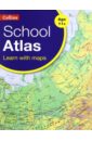
Collins School Atlas
An introductory atlas for secondary schools, perfectly designed to support and motivate Key Stage 3 students in geographical and mapping skills. This secondary school atlas for students aged 11-14 is designed to help develop map, atlas and data handling skills. The content adheres closely to the requirements of the National Curriculum and incorporates results of classroom testing. Its clear and accessible layout will motivate pupils of all abilities at Key Stage 3 and S1-S2. An easy-to-follow introductory 'map and atlas skills' section, useful for both teacher and pupil, is followed by clear, accessible reference maps presented with locator maps, fact boxes and flags, descriptive text, detailed map keys and photos. Carefully selected focus country studies include mapping on contrasting regions and special topics. Regions included in this edition include Russia and the Middle East. The latest available country-by-country statistics are listed in a separate section and the index includes full latitude and longitude values. The world section covers all the global issues required by the National Curriculum e.g. climate change, population, biomes, earthquakes and volcanoes.
1710 Руб.

A2 Size Printed The World Physical Map Fine Canvas Unframed Painting For Home Office Wall Decor
383.72 Руб.

150x100cm The Eurasian Continent Map Political Distribution Map Non-woven Canvas Painting Wall Art Poster and Print Home Decor
1052.91 Руб.

225x150cm Vinyl Non-woven Russia Map Wall Sticker Wall Decor Art Picture Travel Gifts Home Office Decoration Education Supplies
1616.45 Руб.

