south downs way national trail official map
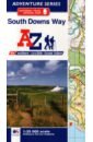
South Downs Way National Trail Official Map
The A-Z Adventure Series of maps combines the best of OS and A-Z, creating the perfect companion for walkers, off-road cyclists, horse riders and anyone wishing to explore the great outdoors. The South Downs Way is a National Trail along the chalk escarpments and ridges of the South Downs. This undulating path begins in Winchester and finishes in Eastbourne covering 100 miles (160km) and lies completely within the South Downs National Park. The route on the map is clearly highlighted in yellow with mileage markers to gauge distances when planning sections of the walk to enjoy. This official National Trail Map* of the South Downs Way features 44 pages of continuous Ordnance Survey 1:25000 mapping providing complete coverage of the South Downs Way. This atlas includes a route planner showing distances between places and the amenities available, featuring: Campsites (seasonal opening) Information Centres Hotels/B&Bs Youth Hostels Public Houses Shops Restaurants Cafes (seasonal opening) Petrol Stations Also featured is advice on safety and security when walking and a selection of QR codes linked to useful websites, including temporary route updates from the National Trails, regional information, map reading advice and weather reports. Unlike the original OS sheets, this A-Z Adventure Atlas includes a comprehensive index to towns, villages, hamlets and locations, natural features, nature reserves, car parks and youth hostels, making it easy to find the required location quickly. Each index entry has a page reference and a six figure National Grid Reference. With a book size of 240mm x 134mm it is the same size as a standard folded OS map. Other National Trails available within the A-Z Adventure series include: Cotswold Way, Hadrian's Wall Path, North Downs Way, Offa's Dyke Path, Pembrokeshire Coast Path, Pennine Way, SW Coast Path, Thames Path and The Ridgeway.
1807 Руб.

China - Mongolia. 1:4 000 000
Explore China and Mongolia with this Freytag&Berndt road map. The best way to plan your trip, prepare your itinerary, and to travel independently in the different regions of these two countries. This map also covers Nepal, Taiwan and South & North Koreas. Inset map of Downtown Beijing ; Place name index on the other side of the map. Touristic information: places of interest, the Great Wall, Unesco World Heritage sites, Buddhist temples, national parks, airports, harbours, ski resorts, beaches, spas. The legend is in English, French, German, Italian, Dutch, Spanish, Czech, Slovak, Hungarian and Polish. All place name in China are indicated in both Roman and Chinese scripts.
937 Руб.

Frankreich Sud. 1: 500 000
Explore the south of France with this Freytag & Berndt double-sided road map. The best way to plan your trip, prepare your itinerary, and to travel independently. Place name index in a booklet. Touristic information: places of interst, national parks, airports, castles, lighthouses, view-points, religious buildings, archaeological sites, monuments, camp-grounds. The legend is in English, German, Spanish, Italian, Dutch, French, Czech, Polish, Slovak and Hungarian.
937 Руб.
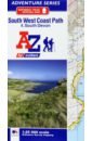
South West Coast Path South Devon Adventure Atlas
The A-Z Adventure series features the accuracy and quality of OS 1:25000 mapping in a convenient book, complete with index. The A-Z Adventure series is an innovative concept that utilizes Ordnance Survey 1:25000 mapping in a book, therefore eliminating the need to fold and re-fold a large sheet map to the desired area. OS 1:25000 is Ordnance Survey's most detailed mapping, showing public rights of way, open access land, national parks, tourist Information, car parks, public houses and camping and caravan sites. Unlike the original OS sheets, this A-Z Adventure Atlas includes a comprehensive index to towns, villages, hamlets and locations, natural features, nature reserves, car parks and youth hostels, making it easy to find the required location quickly. Each index entry has a page reference and a six figure National Grid Reference. At a book size of 240mm x 134mm it is the same size as a standard folded OS map. The South West Coast Path is a National Trail along the Somerset, Devon, Cornwall and Dorset coasts. This stunning walk from Minehead, Somerset covers 630 miles to South Haven Point in Poole Harbour, passing through two World Heritage Sites (the Jurassic Coast and the Cornwall and West Devon Mining Landscape), Exmoor National Park, Land's End and many areas of outstanding natural beauty. This A-Z Adventure Atlas of the SW Coast Path South Devon features 40 pages of continuous Ordnance Survey mapping covering the SW Coast Path from Plymouth and following the route east to Lyme Regis. This atlas includes a route planner providing the distances between places and the amenities available, featuring: *Information Centres *Visitor Centres *Hotels/B&Bs *Youth Hostels *Campsites (seasonal opening) *Public Houses *Shops *Restaurants *Cafes (seasonal opening) *Petrol stations
1678 Руб.
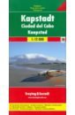
Cape Town. 1:12 000
Explore Cape Town (Kaapstad) with this Freytag&Berndt street map. The best way to plan your trip, prepare your itinerary, and to travel independently in this town of South Africa.
608 Руб.

London A-Z Premier Map
This A-Z map of London is a full colour, single sided, fold-out premier street map, covering a six mile radius from Charing Cross in central London and extending to Muswell Hill to the north, London City Airport to the east, Crystal Palace to the south and Wembley to the west. Postcode districts, one-way streets, the congestion zone boundary and safety camera locations with their maximum speed limit are featured on the mapping. Attached to the cover is a booklet containing the index which lists streets, selected flats, walkways and places of interest and place, area and junction names. Also included is a separate listing of National Rail, Docklands Light Railway, London Overground and London Underground Stations and a list of Hospitals and Hospices covered by this map. In addition, the full London Underground map is featured on the inside front cover. This map is now available at an enlarged scale of 5 inches to 1 mile (8 cm to 1 km). The London Knowledge Map is aimed primarily at people learning 'The Knowledge', it comes as a standard paper map or can be laminated allowing routes to be marked on the map with a dry marker then wiped clean or mounted on lightweight foam board. Supplied in 2 sections, the enlarged map can be butt joined as one if required.
1797 Руб.

London A-Z Street Atlas
Navigate your way around London with this detailed, easy-to-use and up-to-date A-Z Street Atlas. First published in 1936, this iconic atlas is a trusted means of finding your way around the capital city. The main mapping extends beyond Central London from Heathrow Airport to Chingford at a scale of 2.88 inches to 1 mile, featuring postcode districts, one-way streets, the Congestion Charging Zone and Low Emission Zone. The large-scale street map of Central London – at a scale of 5.75 inches to 1 mile – cover Regent’s Park and Shoreditch, Chelsea and Vauxhall, Hyde Park and Bermondsey. A comprehensive index lists streets, selected flats, walkways and places of interest, place, area and junction names. Additional healthcare (hospitals, walk-in centres and hospices) and transport connections (National Rail, London Tramlink, Docklands Light Railway, London Underground and Overground stations, and River Bus pier) are indexed as well. Also included are: • Overview map of the Congestion Charging Zone • West End Theatre map • London Connections rail services map • London Underground map
1310 Руб.
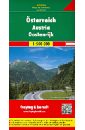
Австрия. Карта. Austria. Osterreich 1:500 000
Explore Austria with this Freytag & Berndt road map. The best way to plan your trip, prepare your itinerary, and to travel independently in this country. This map also covers Slovenia, South Bavaria (Munich, Augsburg, Regensburg), and Northeast Italy (from Milan to Venice). It includes a separate place name index in a booklet and touristic information on main sights in several languages (English included). Other information on the map: places of interest, airports, castles, nature reserves, monuments, scenic view-points, camp-grounds, golf courses, spas. The legend is in English, German, French, Italian, Spanish, Dutch, Czech, Polish, Slovak, and Hungarian.
593 Руб.

Куртка Trailway Pullover Sweaty Betty, цвет Blue Trail Map Print
Бренд: Sweaty BettyЦвет: Blue Trail Map Print
10433 Руб.
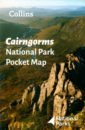
Cairngorms National Park Pocket Map
Handy little full colour map and guide of Cairngorms National Park. Detailed mapping and visitor information to the National Park along with a selection of photographs. Map at a scale of 1:182,000 (2.9 miles to 1 inch or 1.82 km to 1 cm). This small map with additional text and photographs gives a great overview of the Cairngorms National Park, and is the perfect companion for exploring this beautiful area of the Scottish Highlands. Clear, detailed mapping Key park, tourist and travel information Ideal for planning visits to the National Park Index to help locate and plan your trip
748 Руб.

Canada 1:3 000 000
Explore Canada with this Freytag&Berndt double-sided road map. The best way to plan your trip, prepare your itinerary, and to travel independently in this country. One side shows Western Canada: British Columbia, the Prairies, Yukon, and the North-West Territories, and the other side shows Ontario, Quebec, and Atlantic Canada. Touristic information: airports, national parks, places of interest.
937 Руб.

Malaysia. 1:600 000 - 1:900 000
Explore Malaysia with this Freytag&Berndt double-sided road map. The best way to plan your trip, prepare your itinerary, and to travel independently in this country. Place name index. Touristic information: places of interest, airports, national parks, beaches, diving, lighthouses, World Heritage sites, religious buildings. The legend is in English, French, German, Italian, Spanish, Dutch, Slovak, Hungarian, Polish, and Czech.
548 Руб.

Big London A-Z Street Atlas
Large scale A-Z street mapping of London. This A4 street atlas offers the perfect combination of coverage and clarity, the area covered ranges from Heathrow Airport all the way to Chingford at a scale of 4.25 inches to 1 mile, while a detailed map of Central London is at a larger scale of 8.5 inches to 1 mile. The mapping features transport connections, places of interest, public buildings, postcode districts, one-way streets, Congestion and Low Emission Zones This comprehensive street atlas of London also includes: • An overview map of the Congestion Charging Zone • West End Theatre and Cinema maps • The London Rail & Tube Services Map • London Underground map A comprehensive index lists streets, selected flats, walkways and places of interest, place, area and junction names. Additional healthcare (hospitals, walk-in centres and hospices) and transport (National Rail, London Tramlink, Docklands Light Railway, London Underground and Overground stations, and River Bus pier) are indexed as well.
2435 Руб.
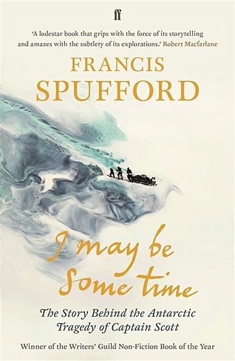
Spufford F. I May Be Some Time
When Captain Scott died in 1912 on his way back from the South Pole, his story became a myth embedded in the national imagination. Everyone remembers the doomed Captain Oates's last words: 'I'm just going outside, and I may be some time.' Francis Spufford's celebrated and prize-winning history shows how Scott's death was the culmination of a national enchantment with vast empty spaces, the beauty of untrodden snow, and perilous journeys to the end of the earth. .
730 Руб.
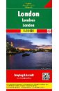
London. 1:10 000
Explore London downtown with this Freytag & Berndt street map. The best way to plan your trip, prepare your itinerary, and to travel independently in the British capital. This map covers: from Kensington Park to the Tower of London (west/east), and from Regent's Park to Battersea Park (north/south). Street index on the other side. Touristic information: pesdestrian streets, parks, theatres, museums, religious buildings, monuments, World Heritage sites, police stations, hospitals, tourist centres, post offices, underground, bus terminal. The legend is in English, German, French, Italian, Dutch, Spanish, Czech, Slovak, Polish and Hungarian.
937 Руб.